Establishing Landscape-driven Strategies to Senstively Integrate Housing, Woodland and Farmland
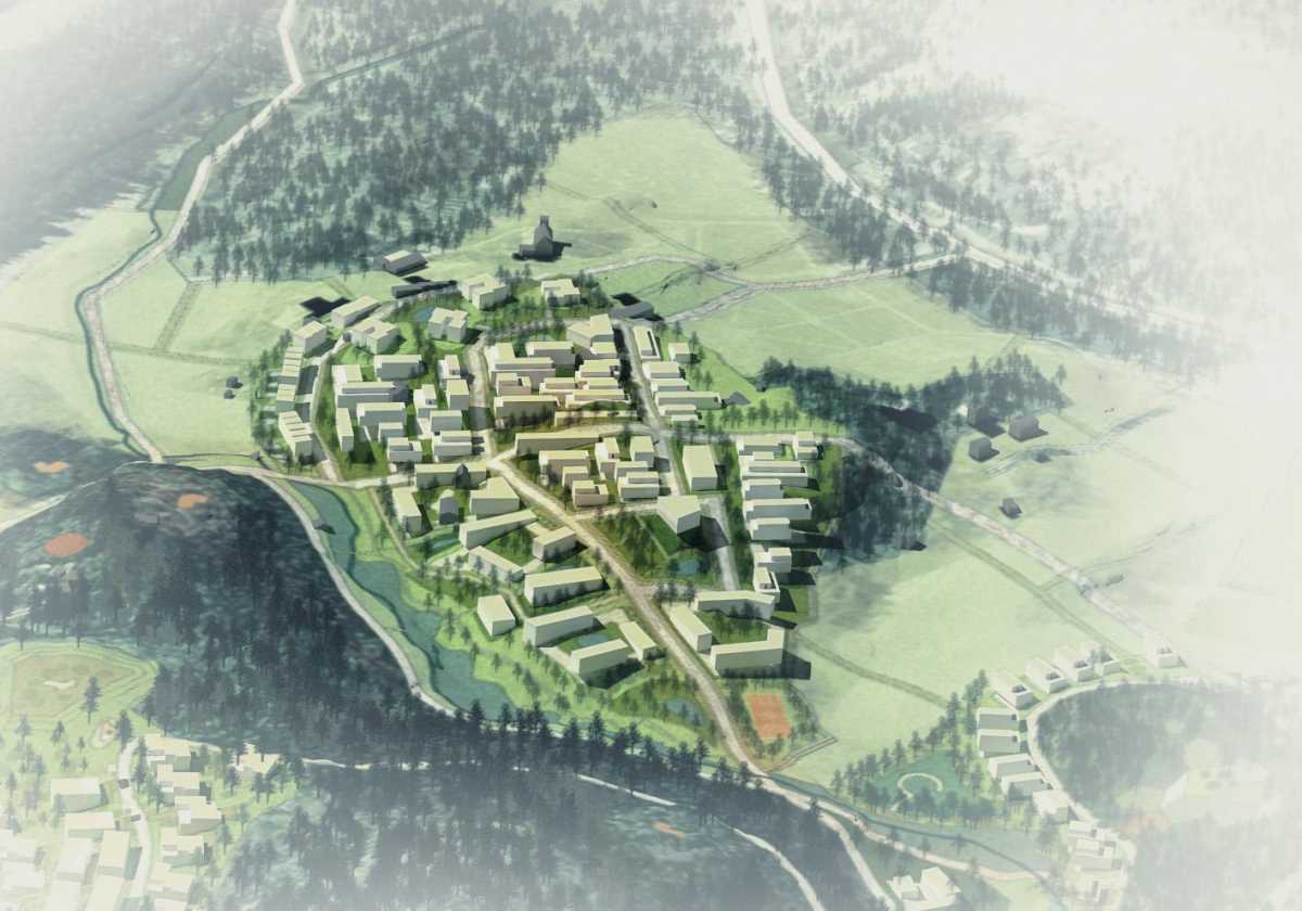
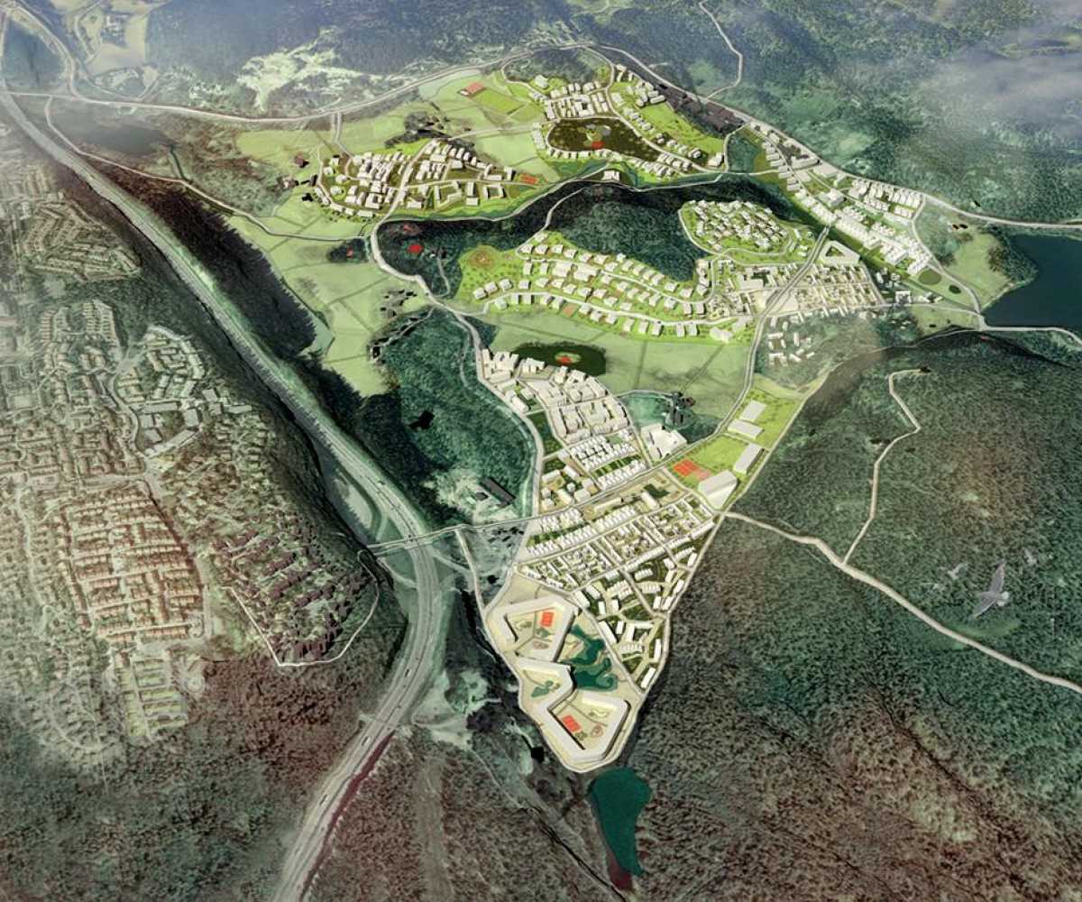
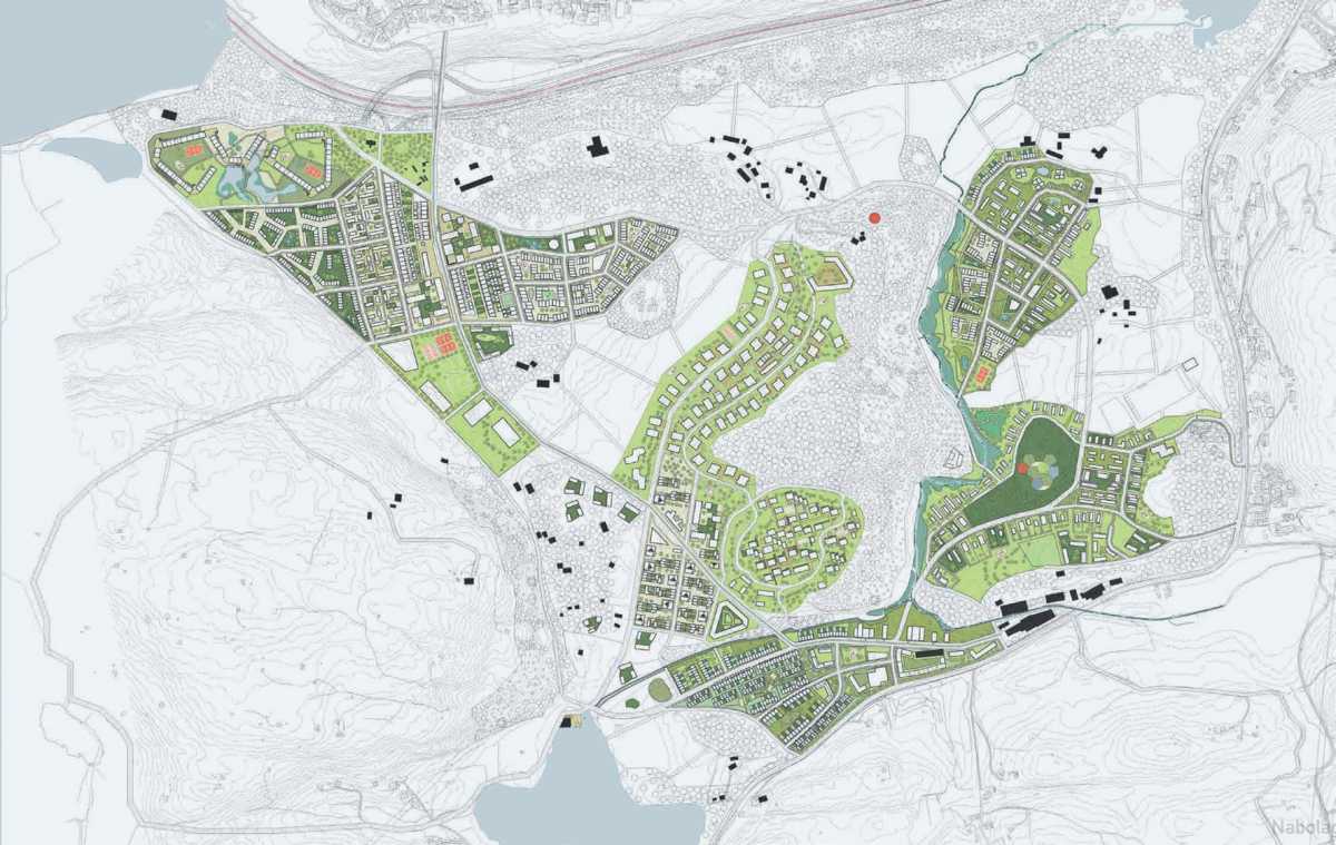
We were commissioned to make a 7500-home masterplan for the area of Gjersrud - Stensrud, one of the last large-scale development zones on the outskirts of Oslo. The site lies between two large mountains and can be roughly divided into two conditions: mountainous areas with poor coniferous forest and low-lying terrain with cultivated farmland, swamp vegetation, streams, hills and lakes. The city municipality owns only a small amount of the site. The majority of the land is sub-divided between numerous landowners and local residents who also depend on the land for their livelihood.
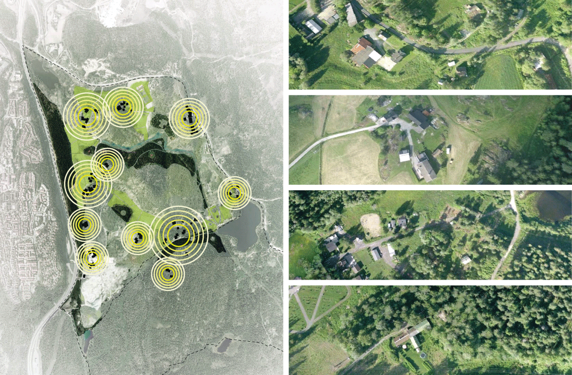
Our masterplan is premised on establishing a landscape strategy that protects farmland and precious natural habitat from future development; making parks and open spaces that are linked to the surrounding mountains and forests; focusing social amenities into development nodes linked to public infrastructure; building neighbourhood centres that have distinct identities and streetscapes.
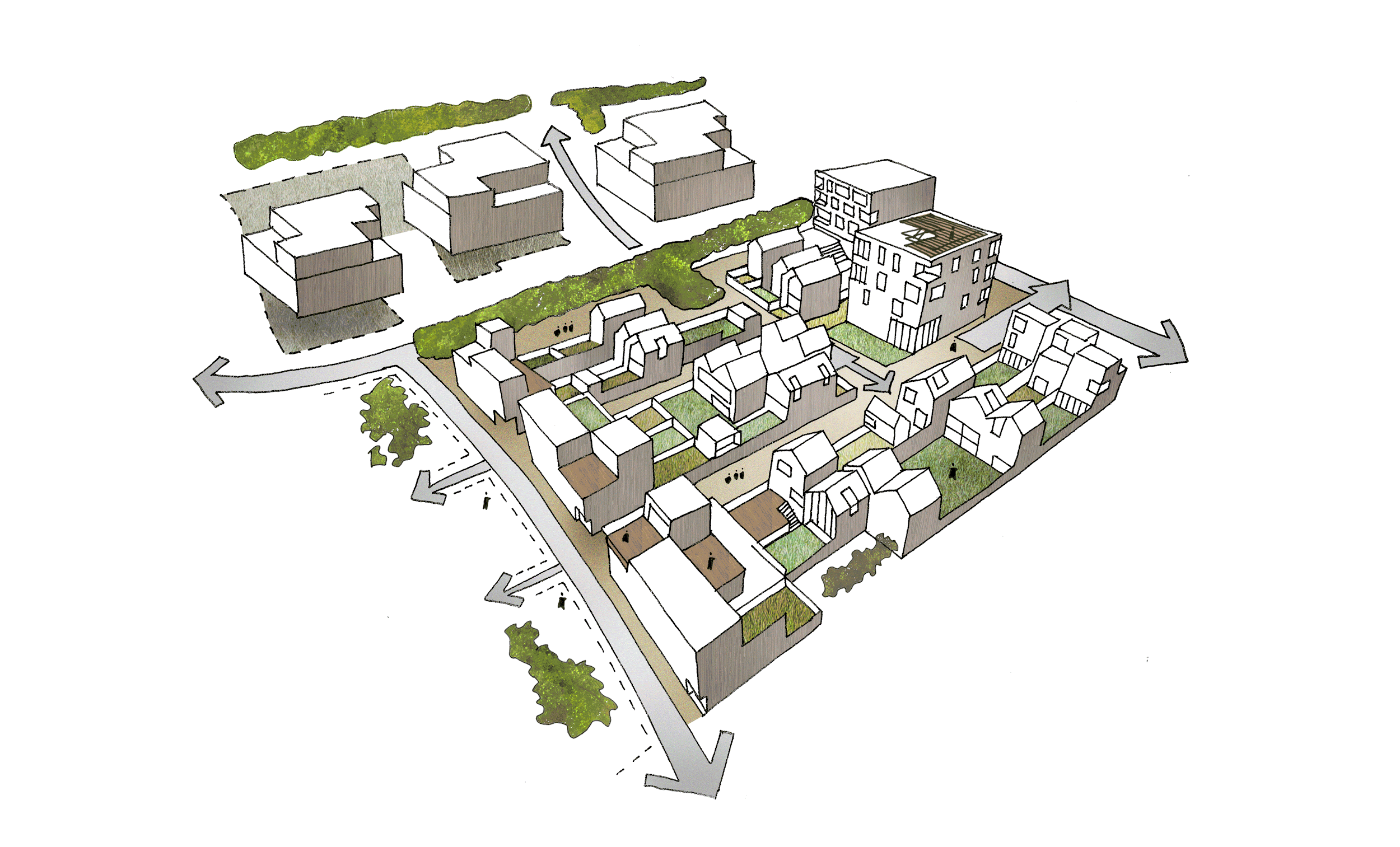
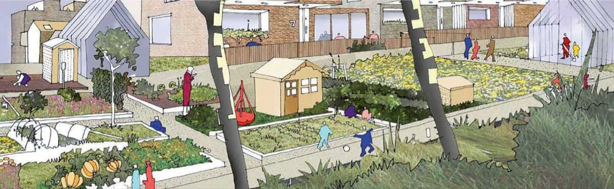
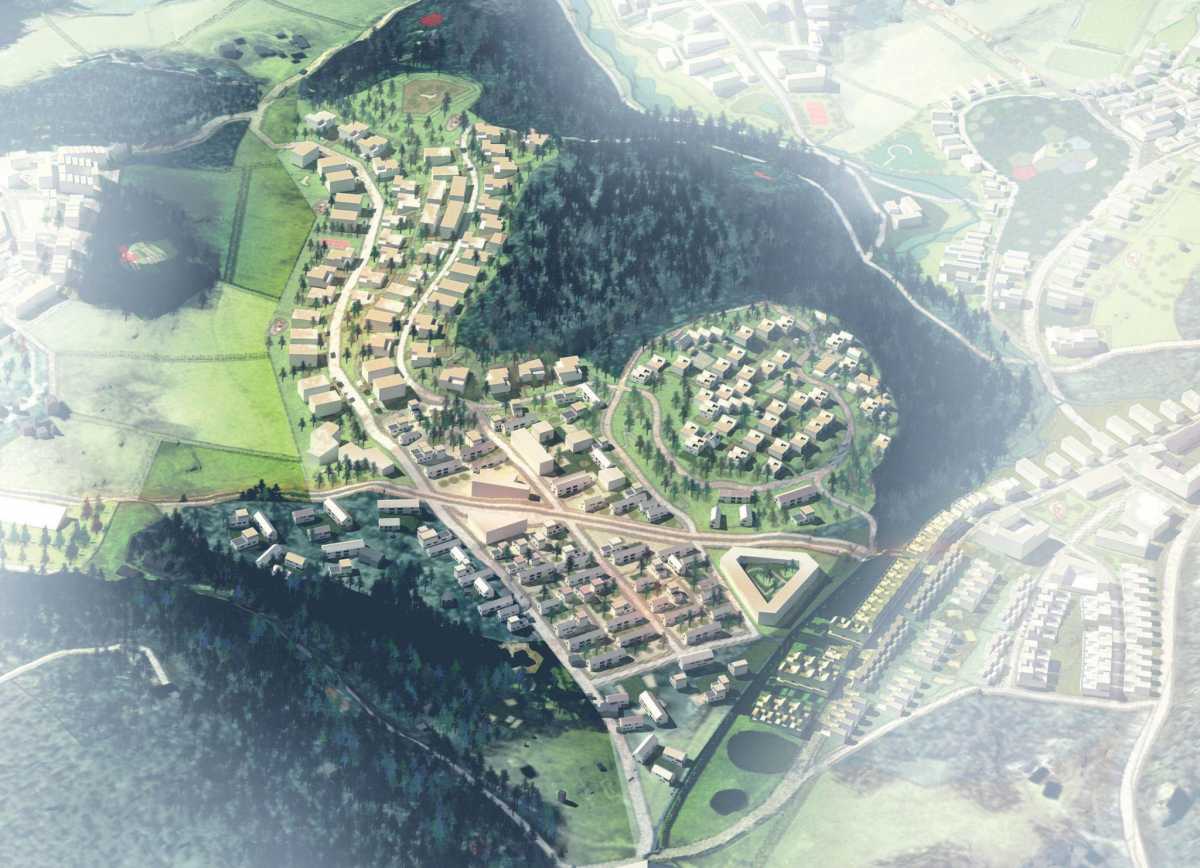
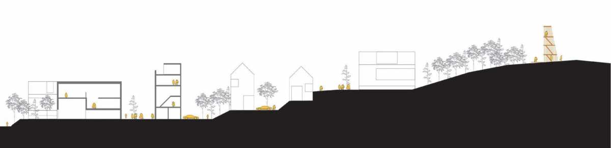
The project offers an alternative model to typical Norwegian suburban sprawl by enforcing an extensive ‘no-build’ zone and by concentrating the low-rise housing into a series of ‘village-like’ clusters of development. Housing typologies take advantage of the topography to organise transitions from public to private space. Landscape and topography are employed to inform then design of village squares, hill-top promenades, courtyards and lanes.
- Gjersrud-Stensrud
- NOR, Oslo
- Client
- Municipality of Bergen
- Programme
- 950,000 m2 residential space\
25,000 m2 public transport hub\
20,000 m2 retail and amenity space\
Site area: 390 ha\
Workscope: Concept Masterplan\
Status: Delivered\
Team: Studio Woodroffe Papa\ 3RW Arkitekter\ Christian E. Mong
Establishing Landscape-driven Strategies to Senstively Integrate Housing, Woodland and Farmland