Prioritising Urban Sustainability and Active Mobility to Create a New Business Hub for Singapore’s Future Economy
JLD, Singapore’s 2nd Central Business District, will be built around the future Kuala Lumpur-Singapore High-Speed Rail terminus and is designed for the flexible long-term evolution of the city’s future economy.
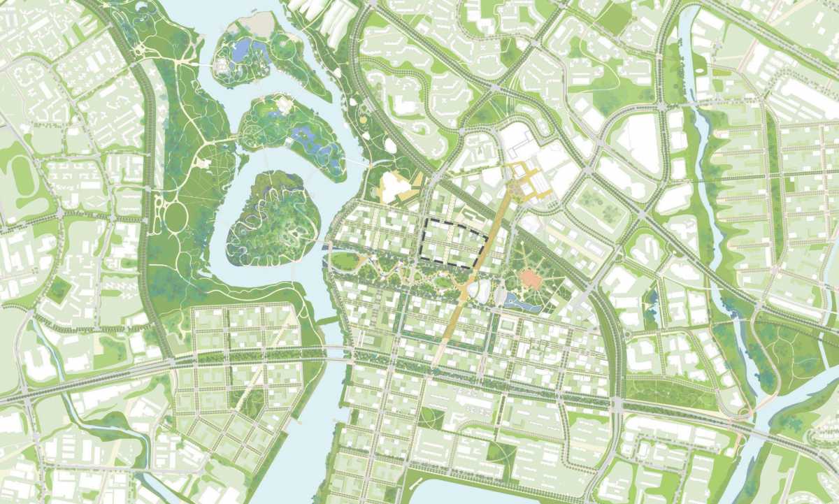
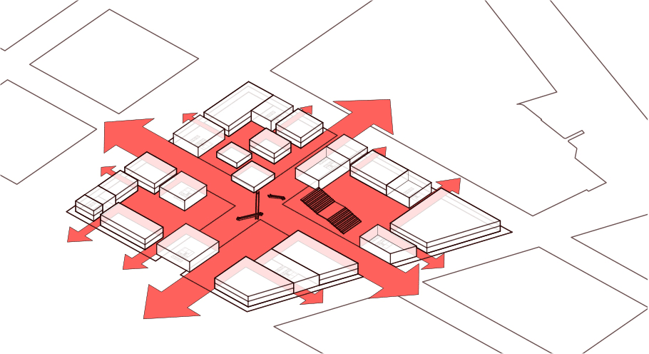
Our task was to propose compelling urban design proposals that complimented KCAP’s masterplan, suited the local context and were highly implementable and adaptable to meet changing needs over time. We translated these urban design strategies to a set of workable urban design guidelines to guide future developers and architects to achieve the envisioned building typology, streetscape and public realm for the district.
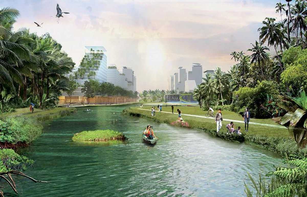
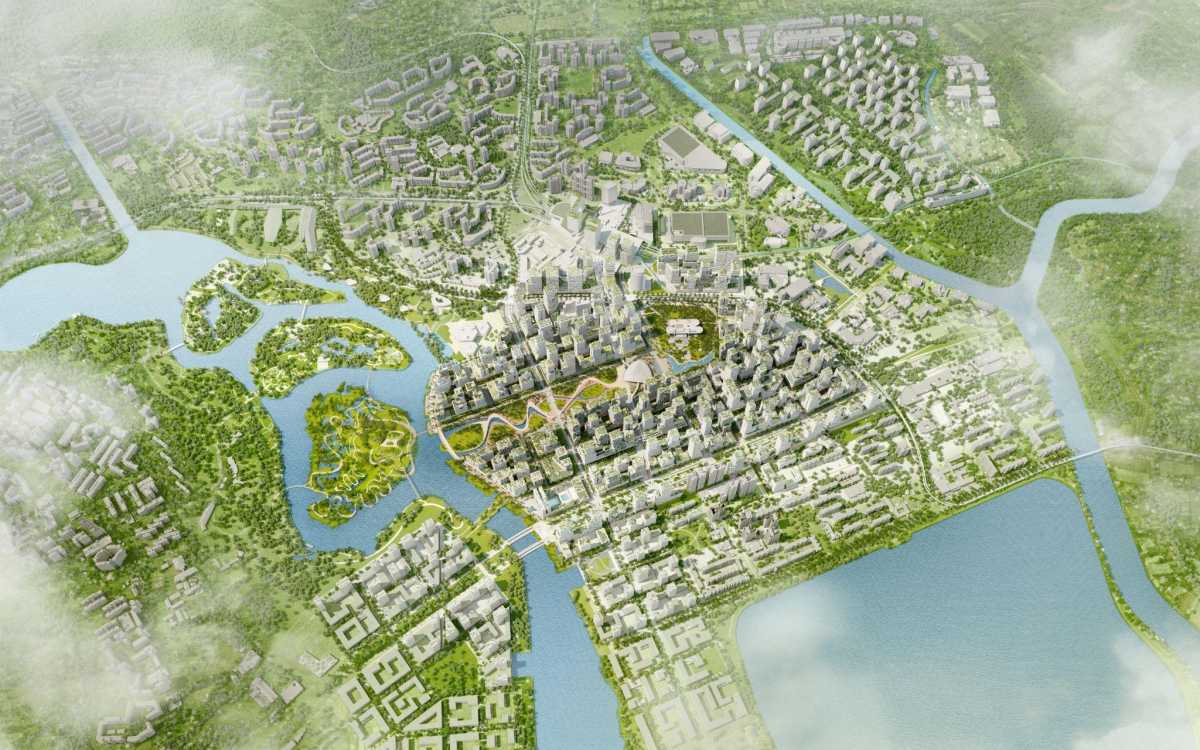
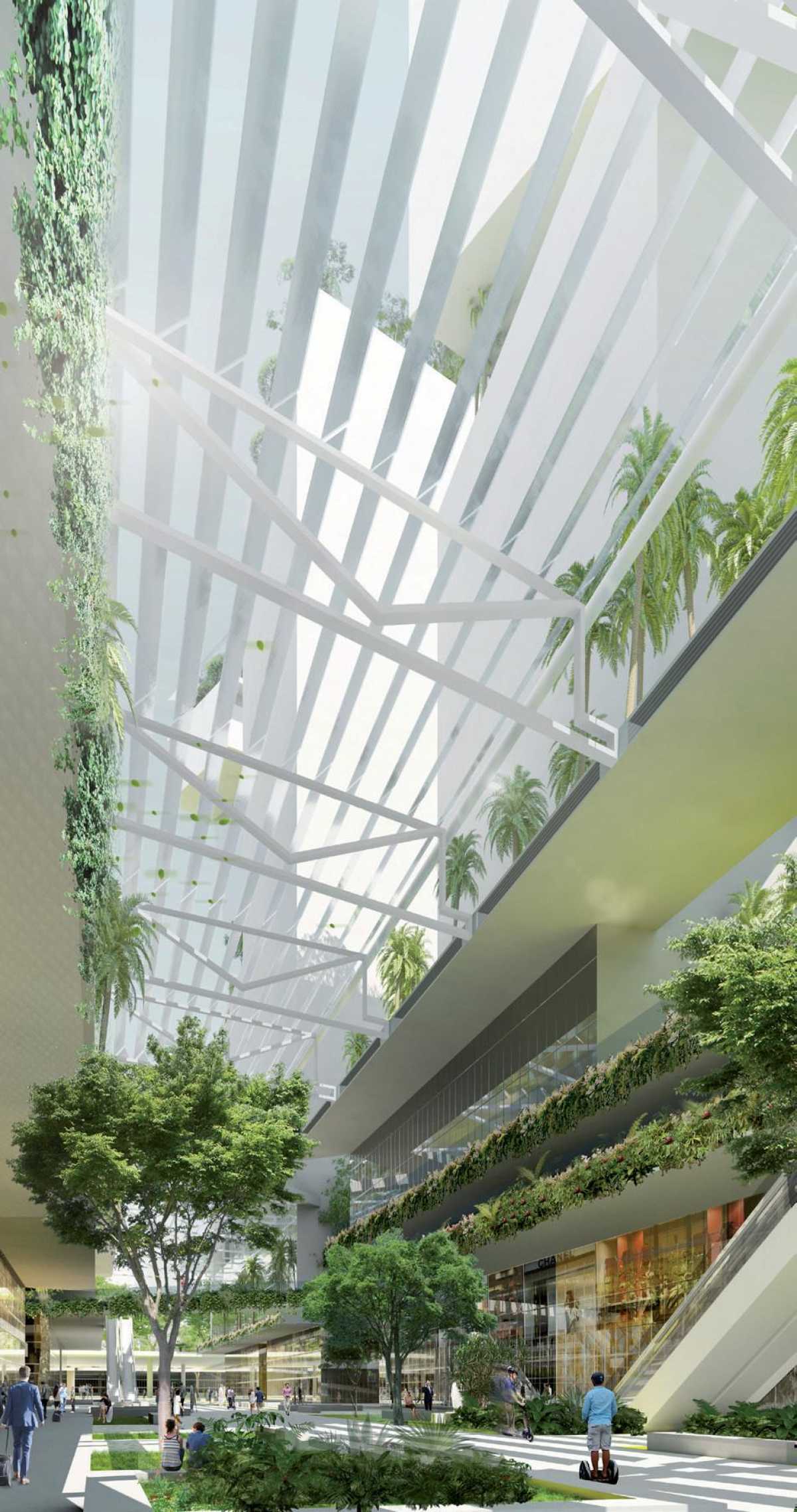
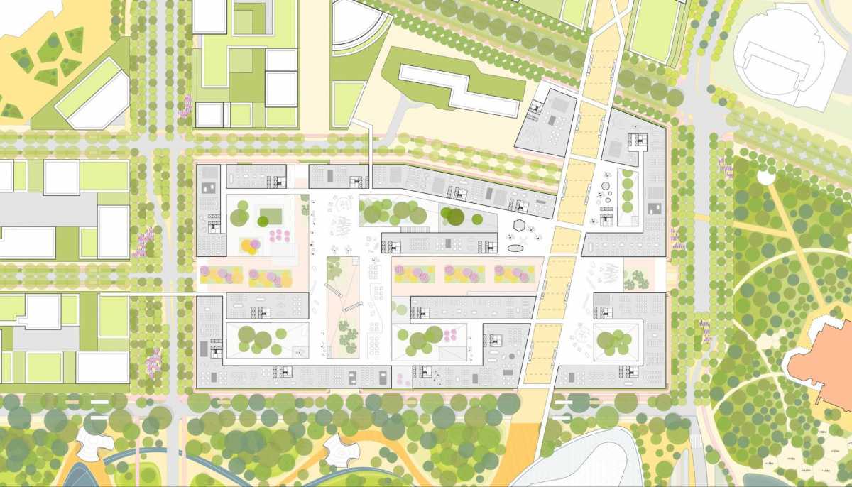
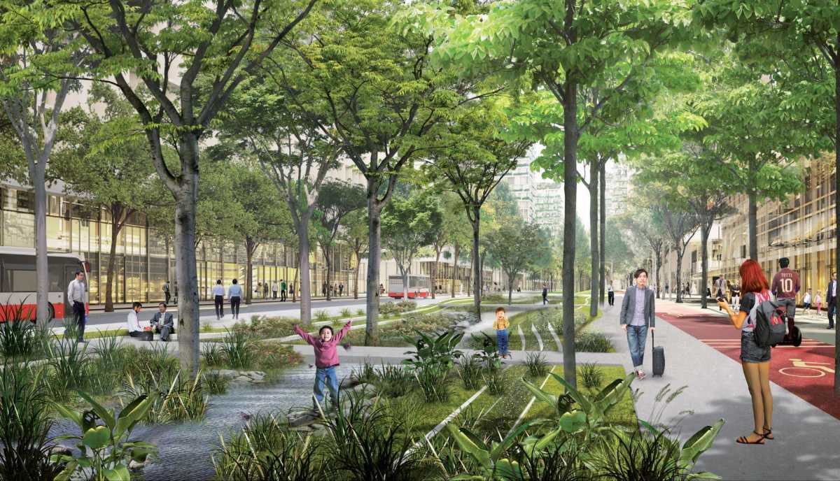
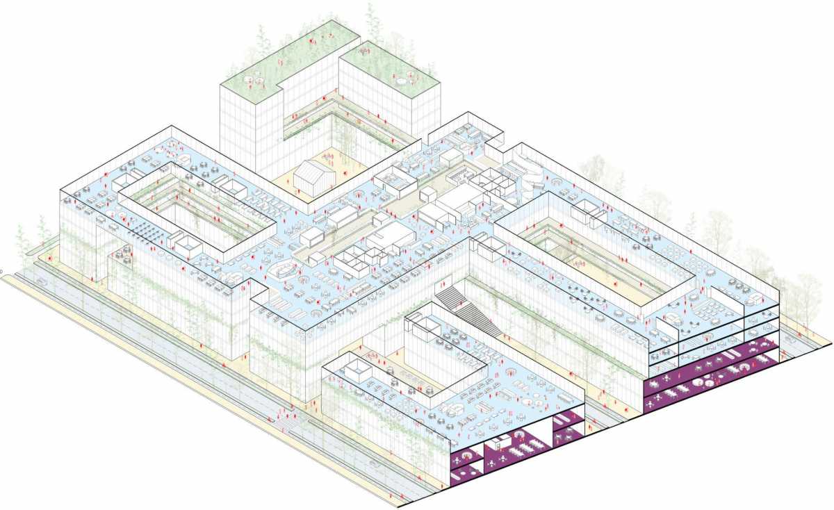
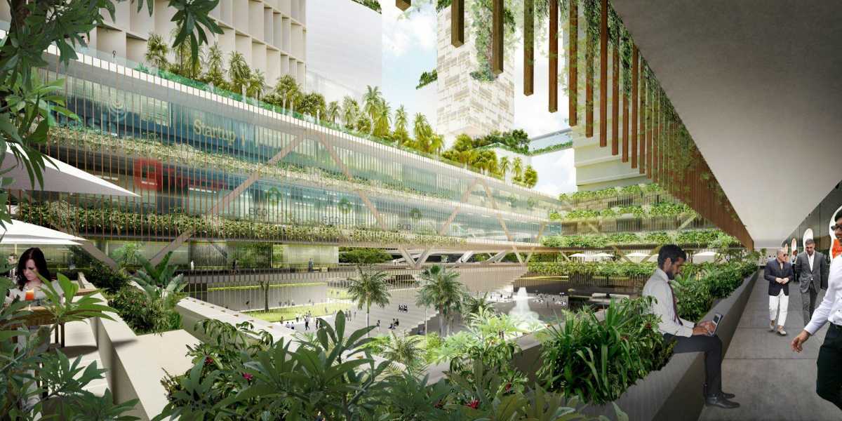
Identified as a model for urban sustainability under the Singapore Green Plan 2030, the district will support Singapore’s ambition to be a carbon services hub and a leading centre for green finance in Asia and globally. The urban block typology maximises vertical greening and incorporates a series of stacked horizontal landscape datum and connections that weave through the entire district to establish a new identity for this district of Singapore. Extensive podium spaces in the lower floors of the blocks are key to accommodating an evolving mix of uses. The porous ground floors, courtyards and through-block pedestrian links create generous public spaces that encourage interaction, networking and a lively public realm.
- Jurong Lake District
- SGP, Singapore
- Client
- Urban Regeneration Authority
- Programme
- 4,000,000 m2 housing, commercial, MICE, retail, leisure, culture and community amenities\
Site area: 160 ha\
Workscope: Urban Design Stratagies + Design Guidelines\
Status: Delivered\
Building costs: \
Team: Studio Woodroffe Papa\ KCAP Architects & Planners\ Arup\ SAA\ Lekker
Prioritising Urban Sustainability and Active Mobility to Create a New Business Hub for Singapore’s Future Economy